Tuesday, July 22, 2008

Oldie - Write-up of 2001 RAMROD

Ran across this pre-randonneur ride report. What the heck, here it is...

Intro

The RAMROD is a bicycle ride; a 154-mile day long road ride around Mt Rainer with an estimated 10,000 feet of total elevation gain. It’s a loop, starting and ending in Enumclaw, so there is also 10,000 total feet of downhill riding.

Pre ride impressions

We drove into the park. The hills were long. In pieces, they were similar to many that I had done before. They were longer than anything I’d ever biked up before. In this ride the hills would start after 60 some miles of gradual uphill riding; I’d be starting to hit the passes tired. Psyched. I’d recently completed a 150-mile ride (day 1 of the STP) and a 105-mile ride (a week later, a reprise of the local century, plus some bonus miles). Both experiences were somewhat painful. Psyched again.

Dad and I drove the out to Enumclaw, the starting point of the ride, the night before; ostensible to pick up my packet; but basically I needed to see the route, and needed to start thinking about how to do the ride in some detail. The drive turns out to be much longer than estimated (2 hours each way from National Park Inn). We barely make the last call for dinner at Eatonville; grabbing a burger at Aarons just before close at 9pm. Got back to National Park Inn a little after 10pm. Did my final packing for the ride and went to sleep.

Started the morning getting up a little after 3am. Got dressed. Took some stuff out to the car. Put the rack on. Woke up Julie and we left. Arrived eventually at Enumclaw. Started riding around 6? Maybe sometime after; hit the restroom etc. before heading off. It was cold. I was wondering what the hell I was doing out there. As I was clearly and evidently apprehensive, Julie reminded me that it was my vacation; and that I needed to enjoy the ride. I remembered this during the ride; but still didn’t stop for coffee in Elbe.

Ride log

Pre-park

It was cold, 50 degrees and foggy. Didn’t get a good breakfast and missed my coffee. But, starting was the first thing to do. Found a paceline early; invited in. Pulled me out of a funk; all the way to Eatonville. Got to re-ride part of another organized ride, the Daffodil, with that line. Nice to see it again; I’d ridden that with my son David and daughter Rhea earlier this year. That paceline and the first hill out of Eatonville did a good job of reviving me. It was great to get to the park. Spoke with a few riders as they passed me. We were all glad to see the sun out; as we were cold at the start. It was good to start the long climb into the park, and eventually up to Paradise.

A bicyclist got pulled over in Eatonville. Maybe ran The Stop Sign? The hills up outside of Eatonville were significant; but, well within bounds. Weber canyon-like; although not as steady. Although when I hit the resistance of the first hill; I though something was wrong with the back (tire rubbing). Nope; just uphill. Kept riding.

The sun came out for me first near Aldar Lake; outside of Elbe. It felt good. Had good speed. Had a good view of the lake. Probably should have had the coffee in Elbe. No big lines.

The ride from Elbe into the park; up to Longmire, is similar to heading up Edison/Union from the river; but longer. From Longmire up to Paradise is like heading up Leslie, but a whole lot longer.

At this point I wasn’t sure I was going to make it. But, I’d felt that way on other rides and completed them.

In the Park

Enjoyed the park entrance to Kautz creek. The bike provided a great view of the undergrowth in the rain forest. Much moss and fern. Good riding.

Lunch at Kautz creek; A bagel, banana, fruit. Filled the water bottles with Gatorade. Someone made a crack about the sanitary conditions. Lunch was set up right by the can. I agreed and then dove into the bagel.

Saw Dad and Laura watching for me outside of National Park Inn. Stopped; talked; some pictures happened. Claimed I was on course for a 12 hour ride. And then took off as best I could. Did alright up Paradise. Up to Paradise

Got passed a lot by skinny people on good bikes, with a good cadence, in groups. Saw a lot of familiar sights. Even on a bike, going uphill, it seemed a little too fast to take it all in. The park is great. The road and traffic were favorable. The road grade varied, which is helpful. Built in rest.

Hit the top; tired. Saw a water stop. Rolled right by. Once I started downhill, I figured I would be finally committed to the completing the whole ride. I started downhill.

Descent 1

The descent from Paradise was good fun. I had to stop after ¼ mile to put the sunglasses back on and zip the vest up the rest of the way. Going down this road was a blast. Good speed. Good bike handling. Good views. Good concentration. We went down the scenic loop; no car traffic. A couple of other bicyclist there as well. We sort of rode together, as we’d spoken over the Nisqually glacier. Tended to get passed by other bicyclist; never exceeded 40mph (the computer recorded 35.something as the max). Easily avoided road hazards. The turns were good. Went by the lakes. Pushed up a small rise and then on down. The descent down to box canyon was done in a group. Some of the folks in the group could hop the gratings. Would have been a very useful skill if it were wet at all (and the gratings were slick). I rumble over them; beat the crap out of the wheels and tires. Tires and wheels took it fine.

Up Backbone ridge

Did well on the climb up backbone ridge. Kept folks in sight and didn’t get passed. Pushed it well; another checkpoint near the top. Stopped just before beginning the descent to refuel; thinking of the final climb to come.

Descent 2
Lots of bumps in the rode to watch for; got by them well enough. More fun on good switchbacks; can take them faster on a bike than in a car. A longer descent than the previous uphill, since we were going to a fairly low elevation (somewhere in the low 2000’s above sea level).

Up Cayuse pass
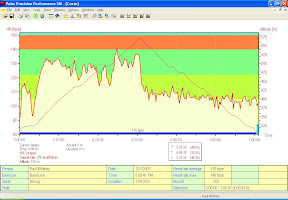
Up Cayuse pass is very steep. And long. During the ride up, the grade appeared flat but the inclometer indicated a steady 7-8% grade. That was almost comical given the contrast in appearance. I was working to go 5-6 mph. I knew that if I looked back it would look downhill. I didn’t look back. A little steeper than Weber canyon; but consistently steeper. I was in danger of overheating and so planned to stop about half way up. That turned out to be the Deer Creek watering stop. The watering down I got at the Deer Creek stop was a lifesaver; there for a good 15 minutes. Shade. Watered both inside and out. From there I was in trouble; still in danger of overheating. Had to stop one more time in the shade. More water and maybe downed my last gell there. My heart rate was in an easy enough place (around 140 BPM); but I had no push in the legs. It turns out I wasn’t eating enough (about half as much as a recommended .5g of carbo per pound of body weight per hour). I finished the pass at a paltry 4-5mph. Spoke with a woman on the way up. She was resting, so I could catch her. She rode with me a few hundred yards. Training for triathlons. Going to switch from endurance mountain events to track riding; thinking she’d enjoy sprinting hard more. Then she powered on up and away.

Cayuse pass was hard. I’d fueled up for it at the top of Backbone ridge. Had a gel; drank half a bottle. Clearly, I should have pounded down some more (note: used up all the gels I’d packed (5?), but left a couple of bars in the saddle bag. Gels win. No noticeable stomach problems (Clif brand)).

Got to the top. And there, even with 45 miles left, the ride was in hand. Downhill all the way; and I was conscious, reasonably coherent and could turn the cranks. The ride folk stationed at the top of the pass took a look at my number (keeping track of who still existed where) and down the other side I went.

Descent
The downhill from the pass is likely the steepest, longest descent on the ride. It’s straight, down a bumpy road. Fortunately, there were no cars to deal with; turns out that most of the cars were backed up behind a tandem. Lightly peddled down to keep the legs loose.

Ride back into Enumclaw
Nobody passed me for the longest time on the downhill. My goal at this point was to get to the next rest stop and have a sandwich. It took longer than I thought it would. Fortunately, there were folks pointing out the stop to weary cyclist. I pulled in, laid my bike down on the ground (I was tired, and mistakenly laid it drivetrain side down. No penalty apparent for that mistake though). And got in line for a sandwich (nobody ever uses the restroom in movies, so it’s the same in this narrative). Ham, white cheese, mustard, lettuce, tomato. Pounded it down. Had a few ounces of Coke. Refilled the water bottle. Overhead someone say: “Our next assignment is to find a tandem and follow it on home”. Tandems are fast on the flats. I headed out. Trying to make as good a speed as I could. Held 20 mph awhile (remember: it’s still downhill somewhat). The wind seemed against me somewhat, but it always does on a bike. Saw a cyclist ahead of me and tried to catch him. Couldn’t, but kept him in sight. Good for pacing. Rode and rode. I was passed by a somewhat faster rider; didn’t latch on to draft. Next I was passed by a much faster group of 4; didn’t try to latch on. The single rider ahead, that had recently passed me, did latch on. Then a paceline lead by a tandem passed. The recently formed group latched on, and I pedaled hard and grabbed on as well. We were going a safe-and-sane 25mph, my heart rate was up (for this stage of the ride) to 149 BPM. I wasn’t going to hang on with this group all the way for the rest of the ride. We passed the solitary rider that I’d been tracking, went through some town (Greenville?) and then I dropped off. But I’d spent some useful amount of time/distance at a high speed. Not really sure how long that lasted. After dropping off, had trouble keeping my speed up at first. A lot of 12-14 mph crud while I was recovering from trying to hold on to the paceline. The solitary rider passed me by. Managed to regain my cruising speed of 17mph (being in the drops helped, and could push it up to 19-20 mph for a few minutes).

My bike computer reset itself at some point during this stretch; not a good thing, as the total mileage, in conjunction with ride sheet, was how I was going to not get too lost. Fortunately, the final key turn I had to make was well marked by a sign and some people, apparently there to make sure bleary/weary riders didn’t just pedal on past. Made the turn. Reset the computer to zero, so I could wander on in the last 6.1 miles. Found the final curvy downhill. I was taking it easy down the switchbacks and got passed again by a fast group. One of them almost lost it. I wandered on in and was greeted by the family, and some food. A warm welcome. A good ride; barely in bounds for my ability.

Post ride impressions
A good ride. A good goal achieved. But, very difficult and nearly too difficult. About 12 hours and 20 minutes total duration. Maybe as short as 12 hrs 5 minutes with the time it took to get started.

There were lots of small groups on the ride; I needed one as well. Pacelines are good for almost 90 miles of the 154 mile ride, and could easily cut an hour off of the total ride.

Screwed up the logistics (although it’s hard to call staying in Mt Rainer park a screwup). Needed to be closer to the starting line the night before, so I could grab a good breakfast, maximize sleep etc.

Fuel
Still have to learn to eat and drink more. The Clif stuff and Gatoraid seem to work fine though. The salt tablets are good. I cramped up on the drive home, indicating I hadn’t eaten and drank enough. Lack of push up Cayuse could have also been fuel-related.

Equipment
The bike worked. The tires worked (Vittoria’s). No flats. The cheapo large water bottles were champs (Diamondback; purchased at GART. Nothing fancy). The sunglasses were poor; too scratched up. Ditched them except for the downhills. I’m replacing them. The bike computer failed AGAIN (Specialized pro model). Managed to reset itself around mile 135. On the STP it reset itself (back to zero) around mile 155. It’s out of here.

Clothing was fine. Minor saddle soreness. Still need to look into a leg length inequality. Might be worth trying another saddle. The bike shorts are starting to get a little baggy due to weight loss. Could use some knee warmers. Not sure how to carry enough food for 154 miles (with altitude gains).

Empty gell-packs are disgusting. How to contain them until a trash can appears is a problem.

Training and Conditioning
Lost ~15 pounds since Jan, and am back in some previous clothes, but still have 25 pounds to give.
Lungs/heart seem good, but need to work on leg strength.
Lower back soreness; the recommended cure is crunches. While I did some weight training, and crunched on the weight days, can always crunch more.

Do it again?
Yes; but, only if I’m in better shape and a better rider. Need to be in better condition to get the maximum enjoyment from the ride. See notes on training, fuel and pacelines. A good group of 3 or 4 would make a huge difference in the effort required.

Strategy
Didn’t stop long at rest stops; I think this was good. Never stopped at a rest stop at the top of a long climb, as there were food/drink stops shortly after down the hill, and I could always coast to food. Kept getting passed by the same folk throughout the ride who were better riders, but stopped longer. This efficiency was good to keep the total day’s duration in bounds.

Figure I’m a 5 to 10-th percentile RAMROD rider. They were a lot of young, skinny folks on really nice bikes. Only saw a couple of Mt bikes; although the gearing is clearly favorable. I could have used an even lower gear up Cayuse.

Wednesday, July 09, 2008

Oregon Randonneurs Summer 600km

Note - changed start location to a cheaper hotel. Corrected end time. There will be baggage transport for the overnight in Richland. And a variation in the route. See here.

Ride: Desert River 600km
Organizer: Paul Whitney (509) 438-2934
Date: Start date: Saturday September 20, 2008.
Time: Start time - 6:00am, Registration - 5:00-5:45am
Start/End Location: The Dalles, OR; Motel 6; 2500 W 6th Street, The Dalles, OR - (541) 296-1191
Finish by: 10:00pm September 21
Entry fee: $40 (+$5 non-RUSA members) - with reduction for own accommodations at overnight. Checks should be payable to "Oregon Randonneurs", also, Oregon Randonneurs membership is required for this event. You can download a membership form and bring it with you. Register Now!
See here for a listing of registered riders.
Medals: Available directly from the RUSA online store.
Route Sheet: Here

Overnight accommodations will be in Richland at the Days Inn - there will be a vehicle to take a small bag for each rider from the start to Richland, and then back to The Dalles.

The Summer 600km for the Oregon Randonneurs will start and end in The Dalles, OR - at the Motel 6. The route will head out across the Columbia, use Washington State Hwy 14 to Plymouth, WA. Then cross over to Oregon for a loop featuring the valley from Echo to Pendleton. The ride then proceeds from Umatilla to an overnight stop in Richland, WA. The next day return to The Dalles is via Benton City, Prosser, Bickleton, Goldendale and Klickitat. Day 1 has about 6600 feet of climbing, Day 2 6000 feet.

Here are bikely links for the current estimated route - a more detailed description follows.

Day 1: http://www.bikely.com/maps/bike-path/ORR-600km-Sept-2008-Leg-1
Day 2: http://www.bikely.com/maps/bike-path/ORR-Sept-2008-600km-Leg-2


We start in The Dalles, at the Motel 6, and head across the river to Washington State Hwy 14. A quick refuel in Roosevelt and then continue on to Plymouth:


View Larger Map

We cross the Columbia on the bike path to arrive in Umatilla OR. The ride then takes a loop, following the Umatilla river towards Hermiston, and then ducking into a scenic canyon from Echo to Pendleton, and then back to Umatilla.


View Larger Map

We cross back over the Columbia into Washington, and head up Plymouth Rd, then dive down Clodfelter into the Tri-Cities. We overnight in Richland along the Columbia river. This map doesn't show the bike path that will be used in lieu of the interstate that the map follows.


View Larger Map

We head back to The Dalles along a traditional Tri-Cities training route - to Benton City and then the Old Inland Empire Hwy (the Yakima on the left, Basalt on the right) to Prosser. Bask in it. Then along the Yakima river for one last moment before heading up and over to Bickelton, Goldendale, Klickitat and The Dalles.


View Larger Map

Tuesday, July 08, 2008

Okie Ride

The Oklahoma Bike

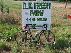
We went to Oklahoma for the annual 4th of July family gathering. I also managed to get some bicycling in. It was hot, humid, and the bike has one water bottle holder - so, I tended to go from town to town, no more than an hour apart. The above is from the Choctaw-TripleX-Luther-Hogback-Choctaw ride. Light traffic. Decent enough roads (mostly asphalt, much of it smooth enough, and a couple of miles of gravel). Great scenery. The route is driven by the North Canadian River. I took every opportunity I could to cross it on new bridges and old. Once out of the flood plane, the ride went to hills. The hills seemed to be driven by water erosion, and there seemed to be about a stream per mile, so one up-down sequence per mile. Saw a heron, a large variety of hawks, a turkey buzzard (munching in the middle of the road) and a box turtle. One hawk got my attention by diving into a field about 10 yards from where I was riding. Another by flying about 5 yards up and across my ride-path. There were bicyclists out and about other than me. One with a back-pack heading towards Luther as I was riding out. And then a small pack of roadies taking it easy on the 4th.

Farm land and flood plane Bridge over the North Canadian River Triple X and 50th A mile's stream Hogback Rd Box turtle on the road

We also had non-cycling recreation - fireworks and paintball.

Fireworks Sky-shot Face Mask - Post-Paintball

Sunday, June 15, 2008

Oregon Randonneurs Sneeze Grass 400km

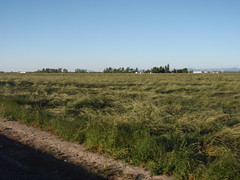
Field of Sneezegrass

The Oregon Randonneurs Covered Bridges 400km route went as promised. Lots of covered bridges. My redundant photos are here. My primary reasons for riding though were that 400km is about my favorite distance - plenty long enough so that plenty (everything and anything) can happen - but, done in a day with time to get home and get ready for the work week. And, the previous week I DNF'd the SIR 600km at the 400km mark. This motivation is not unique.

It was a good brevet. Two points of uniqueness were the extreme allergy symptoms I managed to experience (I ended the ride with a good case of Jabba-the-Hut face. All swollen). There were fields upon fields of the grass/allergen shown at the top of this posting.

The other point of note was that I rode about the best brevet I could, given my condition (or lack thereof) and the ride conditions. A nearly even effort over the 400km with no bonking, excess effort or dead spots. Here's the breakdown:

Leg HR Speed
km bpm km/hr
74 116 22.4
29 123 21.9
67 118 21.6
50 116 20.1
38 121 22.5
77 116 20.6
15 104 20
50 104 20.9


Another high point - it was the first Brevet I'd had with Dan Fender in multiple years. Good to catch up with him again, and I ended up riding some with both Dan and Brian. Rode briefly with Lynn and Jason. Also had a good stretch of riding with Narayan, and managed to draft (slightly) off of Scott's excellent recumbent. Had some time to chat again with Bill. Finished the ride with John Vincent - he was riding well. I speculate it was a fast 400km time for him, as it was for me.

The cycling high point of the ride, for me, occurred while toiling on a 30 mile flat stretch against a head wind. I was passed by Dan and Brian, working together. Invited to join in the pace-lining, I did and we turned the chore of that stretch into good clean fun.

Another great day on the bike.

Monday, May 19, 2008

May 2008 400km

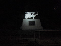
The Cow Looms through the Dark

Synopsis: Words escape me. It was a long ride. Had a great time with great people through great geography and towns. A rider was concerned that I'd take a photo of them barfing (I wouldn't). I'm a little beat up but recovering and training to go again. A nice picture of my bike is here.

Slightly Longer: We started early - and I was off the back much more quickly than usual. The sharp uphill made for a quick separation. Rode some alone, then with Peg and Leslie, and then ran across Jeff. Hadn't managed to ride with Jeff since July 2003. We had a nice chat up and over the top of Snoqualmie pass. For some reason, I fell faster than Jeff down the other side; then ran across Gary, a fellow Tri-Citian and one of the three Randonneurs from that part of the world. He was three tubes down at that point. Stopped to chat and offer what assistance I might. The eastward shoulder of I-90 continued to be my personal bike-reunion lane - found Naryan and we rode on into Cle Elum together.

Had a nice stop (grabbed a sandwich and ate a fair amount of it; more water) and headed on towards Blewett pass with Naryan. An amazing day for cycling - third ride in a row this way. We hit an uphill (the wind was amazingly neutral today) and wandered up. Traffic wasn't particularly an issue. A good number of cyclists on were on the road. I enjoyed the climb. Up at the top of Blewett was a water stop and a few other randos. I didn't spend a lot of time there - added some water to the mix and headed down, as quickly as gravity would go. No issues. More sun. Good scenery.


Here are some pictures:

Cyclists on Blewett Pass Raging waters in context Raging waters - further upstream Sunny day Dan at Skykomish, plus bikes

Some more pictures from the event from another rider are here.

Just looked it up - beat my 2004 time on a near identical course by 2 minutes. Remarkably and bizarrely close to the same time. Weird enough.

Wednesday, April 30, 2008

The Youth of America On Bikes Doing Paperwork

The Youth of America on Bikes - Doing Paperwork
The ORR 300km was great. I've been to Balliston. A fine route. Great company. Near perfect cycling weather. From a technical perspective, the ride went more or less according to plan. The technical goal was to ride at about 120bpm and average about 22km/hr. Near hits at 125bpm and 21.8km/hr - close enough, especially given the (lack of) cycling so far this year and the fact that I'm working at my typical January weight in April. Other goals were to ride with people, take a few pictures and enjoy the day. These all happened.

The weather was as good as at gets. A little cold in the morning. A little warm in the afternoon. No rain. The wind was not a factor. Enjoyed the ride out of town, and the ride up the hill towards Timbers. I took a few pictures as we worked our way towards the coast:

Further Up the Hill Reading available at the Scenic Overview Bike Enjoys the Scenic Overview

We got to the coast, there were some nasty hills, and some great views of the ocean. Into Pacific City for a snack (I had coffee). And then back over Sawgrass from the coast - a simple enough climb.

Somewhere after Grande Ronde I realized I had a flat - dropped out of the group. First pass was just to inflate the tire (a mistake - but, it seemed like it might work at the time. Don't ask. It was a complicated rationalization that was shown to be clearly incorrect). This cost me about 4 minutes of non-riding time. I worked myself back within sight of the group (took about 30 minutes) when it became obvious that the tire wouldn't hold the rest of the way back. So, I stopped and replaced the tube completely. More than 4 minutes. Resuming I took it easy at first. Rummaged through the front bag for a snack. Ate a bar. Called home etc. Basically with 70-80km to go I felt great and was taking it easy. Took a picture across a field when I saw part of the group - two riders in the distance (Bill and Ray).

The Approach to Balliston

Eventually caught up with some of the people - the photo at the top was at the point of regrouping. In the group was a person who might know the origin of the phrase 'faffing around'. Enquiring minds wanted to know. I received a little more insight into the phrase (subsequently, at home and hitting the web, I found no satisfactory history of the phrase. The intent and meaning are clear from context though).

Eventually I ended up riding in with Bill - we'd finished another long ride together once. It turned out to be very good for me that we ended up riding in together. I started 'sugar cycling' after dark - and hit a sleepy patch. He was riding stronger; but, stopped at a few key corners to mark them so I didn't miss them in the dark. Thanks Bill. We got in a little after 10:00pm. Another great ride.

Tuesday, April 22, 2008

The OBM 1200 - Approaching from Richland


John Kramer's mapped out an 'interesting' sequence of rides in Eastern Oregon - the OBM 1200.

Conveniently for residents of Hood River, White Salmon, or even Bingen, the OBM1200 ride sequence starts and ends in Bingen. The OBM1200 is a sequence of permanents put together to result in a tour of a great part of the world. Of course, they're permanents. One could start and end anywhere else convenient and join the festivities in progress. One could link other permanents into these permanents...

The map above shows a nice, direct, and interesting route from Richland (there's a Starbucks AND a mini-mart near this start location) to Heppner. And a finish from Condon to Richland looks like this:


This doesn't add up to a nice 1200; but, it certainly adds up to an interesting sequence of days on the bike. See you out there in the middle of nowhere.

Saturday, April 05, 2008

Flexibility - A Non-Ride Report

This would have been useful to have with me
The short version of the non-ride report for the re-do of the spring SIR 300km: I left behind my front wheel. The longer version of the report is better. Pictures that capture aspects of the alternate activity for the ride are here.

It says something (interesting?) about how the brain works that I realized I'd left the wheel behind a few miles from the hotel, at about 10:45pm. The brain pieced together 1) that for some reason the garage door was still open when I sat down in the car to leave (I hit the remote control button and drove off) 2) I didn't have to move the wheel in the trunk when I went to get my dinner contribution and 3) I had no recollection of actually putting the wheel in the car. It would have been better to have had those thoughts juxtaposed all at once much earlier in the evening, much closer to home. But...

I ended up getting good sleep and having a rare day. Tomorrow - a nice 80-100km ride to maintain training and I'll have to work to get a re-re-do 300km on my schedule.
Each of these cyclist had a front wheel

Thursday, March 20, 2008

600km - One Detail Among Many


View Larger Map

I'm organizing the Fall 600km for the Oregon Randonneurs. There are a couple of options - the most 'interesting' of which will put riders through Yakima, WA. So, that and a few other reasons makes it a good excuse for Dave and I to take an easy ride around Yakima (he's not running; but, his team is running in Yakima and he can take a look/cheer) . The above is the plan, except at no time will we be on the interstate. We'll take the bike path (I'll take notes and note distance on the odometer). Should be a good Saturday ride.


And it is! It's an hour+ drive to Yakima, and then we have to drive across town to West Valley HS - the track meet is in progress. We unload the bikes and head out, down a hill towards Summitview Avenue. This is a nice road. Good shoulder and friendly traffic. It's a gradual climb up Summitview and then a quick downhill towards Cowiche. We lose our wide shoulder for a few miles just before Cowiche, but, it's brief. Then we head up again outside Cowiche. And we get a very very fast downhill from Cowiche towards Naches. It's a good, fairly steep downhill with a straight shot part that lets us take our hands off the brake levers for part of it. Good fun. Then into Naches and a traditional Shell mini-mart stop. Fritos and water.

Our next segment is along the Old Naches Hwy. We have to hunt for it - the big clue - it's 2nd Street. We discover this after some minor bonus hillwork. And, the big clue was actually another cyclist heading towards Selah on 2nd street. This is a nice stretch of road. Not much car traffic and so great for bike traffic. A rough surface for the most part. Lots of orchards - each with its own unique design of smoke-heaters. We decide to get creative about our route to Selah - but, manage to get there eventually. We climb a nice ridge and then get a great ripping ride down Crusher Canyon into Selah. We find the bike path, get to Yakima and find and wind our way back to West Valley HS.

The bikes are put up and we go to watch part of the track meet. It's a great, sunny day. The track is scenicly situated so that one can see the surrounding hills. Dave's teammates are running well and having a good meet. Dave's job for the day was to ride easily. His mission accomplished. Mine too - the Old Naches Hwy and associated climb and plunge into Selah is a great stretch for cyclists.

Sunday, March 16, 2008

Contrasting Options for ORR 600km

I'm organizing the fall 600km ride for the Oregon Randonneurs. My initial thinking was that a challenging ride was in order. Cold, high and far - something to lift the spirits with a feeling of accomplishment at the end of the season. Then, I faced the wall that was the SIR 1000km in September of 2007. It was nasty up there. And wet. And very cold. 400km and change was plenty of that for me. And so I was inspired to sketch out a lowland option. Below are indicators of each option. Whichever it is - the details will vary. But, these are enough to give one an idea for each option.

Here's the high option:

View Larger Map

Or

One could stay low:

March 2008 200km

South View from HWY410 heading up to Greenriver

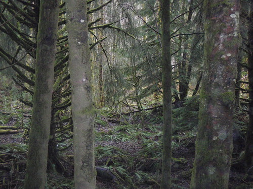
I write these to help remember the rides. The picture above is a good case in point. It's what you see to the South of Hwy410 between Greenwater and Enumclaw - a deeply mossy forest. The first two times I went by this I didn't notice. It was back in 2001/2 on the Ramrod - towards the end of the ride and I was hunkered into a paceline, holding on as best I could while working right at my physical limits. We blew by this stretch. Now I try better to remember.

It also helps that a lot of folks document. Here and here are some good pictures, and there will be multiple ride reports - here's the first I've seen. Wait, another.

First organized ride for me this season - a big ouch and solid evidence that 'training' has been inadequate - but, another great ride. Overall impressions:
  • Set out too fast and finished slow - can't help it, fast is fun too but can only hold on with the quicker riders for awhile, and then I'm left recovering. Ran into more than just a food issue - some muscle soreness as well.
  • That was a cold cold rain. Really cold.
  • Having designated card-signers was a brilliant solution to having 100 or so riders locust in on a small convenience store or bakery. The obvious joke: Bob was going to be there to sign my card at every control - and that wouldn't look suspicious at all...
  • The chili event was great - got to meet a few more people, chat with some I already knew, and have some great recovery food.
We arrived too early at the start - and eventually started. The route was the same as last year, so I more less followed folks and/or remembered the way. It's a nice ride through town on a Saturday morning, and then up the hill that's between Kent and Puget Sound. Eventually you get some nice views of the Sound and then head back the other way. The highlight is the Green River Valley. Traffic's light and I fall in with a group - and play some more. There's a hill on the other side, and I know I'll go slowly up that. We get there eventually and I do. And then the bakery - another card signing outside - and then I look for water. I find it nearby.

I ride alone the next segment - mostly because I've neglected food. People whoosh by. So, I eat a little more for a hour and by the time I'm to the intersection of Mud Mountain Rd and Hwy410 I'm more or less back to normal, and keep riding up. The picture above is one of a few that I took at an impromptu stopping point. Across the road was clearcut. No photos. Finished the ride to Greenwater. I'm up for coffee and Fritos. Here's the store:
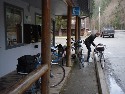
Bikes and Dan at Greenwater Store

Peg rides up and I decide to wait - to finish this particular ride with. So, we do with a small group including Theresa. The sun was out for this last part. It took awhile to finish - a little over three hours. I was glad to be done.

So, I'm at Greg's house and get cleaned up, have a seat and eat veggie chili over rice. More people cycle through the food area, and I get to chat with them. Some discussion of photography and questions about whether a camera had died (I'm guessing yes), some of WSU and a ride from Richland to Pullman, discussions about the cold and clothing, and an actual statistics question. A little over an hour later, Nat arrives. We make a signing ceremony out of it. It was a challenging ride.
Nat completes first SIR ride Nat recovers

Equipment notes:
  • The camelback would have been useful - there are some good distances between convenience stores, and carrying more water means less stops.
  • The handlebar bag worked fine enough - better water resistance. Less size though.
  • I was cold and now about ready to break down and try a wool jersey.

Sunday, January 27, 2008

January Training


Well, you have to be flexible with respect to bicycling schedules in the winter - with the non-bike-friendly weather, travel and darkness. So, today the kid and I walked to the grocery store for 'essentials' (to support baked goods: ingredients include oatmeal and chocolate chips). The snow offered some nice resistance for the walk. And then there's the shoveling of the walk and driveway. We gathered another 1/2 inch of snow while shoveling. Hot chocolate is a recovery drink on par with chocolate milk (anybody buying that?). We've another 2 inches of snow since then, so I think I'll get another rep in before day's end.

While I've been 'iced out' more than once, there have been some breaks in the weather, and did this ride last weekend:

View Larger Map

Sunday, December 30, 2007

Years in Review and in the Future

Here's the annual summary updates for this year, both distance and exercise time. Cross-training added to the time, and probably supported an increase in distance over the past couple of years.

Here's the distance summary:


And here's a view of total exercise duration - mixing across cycling, hiking, weights and a few jogs:


This next year's objectives include completing another Brevet series, and accomplishing additional multi-day ride(s). Cross-training continues in the form of yoga-like activities and further investigating whether the body will support running.

Sunday, December 02, 2007

Definitely on the Bench

Even the gradual running program on the treadmill and trails was a bit much for the joints, so I've backed off of it. I won't be running the 5km on Dec 22nd. It'll be broken running or a 1 mile walk. I've kept walking and riding though. I plan to reboot the running program back at the beginning, skip the treadmill altogether and keep it on the trails. Outside's nicer than the gym anyway.

Yesterday as a great hike after dark up Badger Mountain with Rocky a.k.a Barky, Barktholomew, Barkimus Maximus, Sir Barksalot etc.

It was below freezing, dark and late enough that we wouldn't run into people on the trail. Perfect given Rocky's friendly-but-aggressive-looking behavior. We headed up. The trail was snow covered. I had my headlamp and the fist-full of light; but, needed neither. Plenty of light from the city reflected by the snow. The trail was compact snow, so fairly slick. Rocky had no problems and neither did I, unless I looked far-field while trying to walk at the same time. We walked up through a small cloud - a typical winter day has the local hills each capped with a cloud, so no surprise with the cloud. The city lights were evident. The new shopping areas were totally lit up, neighborhoods less so. There was a dark patch which is an orchard, undeveloped so far.

I never saw a coyote or rabbit, although a few times Rocky stood at attention and looked in a fix direction in the distance. I never was able to see what captured his focused attention. He had a blast - running off the trail in all the interesting directions I don't walk, since the guidelines for humans are to stay on the trail. I'm thinking he covered about 4 times the distance I did. He's social and does a good job of staying in contact while running all over the hill. So, we crested the hill more or less together and then headed back down. No physical issues. A great walk in a winter night.

Saturday, November 03, 2007

Bench Racing

One of my friends calls the part of the ride that happens before or after the ride, when you talk about the ride - 'Bench Racing'. It's bench-racing season. It's pleasant to consider goals for the upcoming season, ponder equipment alterations and swear (for the n-th year in a row) that some mass will be lost before the next season begins. For goals: I'm liking the thought of doing a Brevet series, a Fleche, organizing a Brevet, and other TBD. Maybe that's enough goal; maybe not.

As for what's immediately next - I'm executing a combination of this running/jogging training activity, with some weight-like training. Exercise ball and balance stuff. So far it's well verified that I have no upper body or core strength. Plenty of room for improvement. Then, add a weekly spin class to remind the cardio system about what's what. Very different than previous fall/winter approaches in that cycling is not featured. But, the previous 5+ fall/winters I managed to put on a comfortable 10+ pounds. It's past time to try something different.

The interim goal is a 5k run: The Cable Bridge Run organized by the City of Pasco. It's been a really loonnngggg time since I've even contemplated such an event. The goal is to complete the distance without hurting myself while mostly jogging before they close the course. I've seen the t-shirt - it will look good on a bicyclist.

Tuesday, October 09, 2007

That Was Fun - The Coffee Was Good - What Next?

My rando-season ended with a nice ride through and above the Columbia River - The Oregon Randonneur's Bingen Bikenfest. Lots of fun. Pictures and other stories are linked from the ORRando web site. I did the ride with Nat - his first 200km adventure and personal longest ride ever. We started out from Bingen with a nice end-of-the-year crowd. Great to see the folks and hear about the various adventures. The pack eventually left - and I stopped as soon as possible to get a cup of coffee - actually a water bottle full of coffee to compliment the other water bottle full of water. Accomplishing this (after less than a mile of riding) I headed out to catch up with the folks, and joined Nat, and played leap-frog with Lynne, up-river along the Columbia. Nat and I generally stopped for some of the historical markers, and lolligagged along at the back taking in the day.

Then we got to Hwy 97 and headed up to Goldendale. It was comically unfortunate: steep uphill and against a cold cold wind. I'm still laughing. We suffered uphill at our respective paces - still taking time to read historical markers - and eventually cleared the hill and found our way into Goldendale, and the control stop. There were a few rando's there - we chatted briefly and decided how we might proceed. And by 'proceed' I mean figured out what to eat. I went with the Hostess Fruit Pie (I want Hostess to sponser my mid-pack, mid-weight, rando riding. I'm thinking a jersey that features various of their fine products. Sure, I'm partial to the Fruit Pie's on these rides - but not averse to sporting a snowball or dingdong or frosted Donnette (I like the chocolate), tastefully arranged, on a bike jersey and/or shorts). And more coffee. We spent enough time their that I got to see Lynne's thermos for Tea. Chat briefly with Ricky. Interact briefly with a woman doing a marathon drive back to a town South of Eugene Oregon - she still had a long way to go - especially from the point of view of staying awake. And the proprietress in charge of the gas-station part of this set-up seemed intrigued by the thought of her contemporaries out on some marathon bicycle slog along the Columbia, across the Klickitat, and back. She seemed to actually want to grab a Rando-bike and go for it. Maybe she will. So, anyway, Nat and I sit down to eat. He's in for the Sandwich (it's a combo shop - gas station/mini-mart/subway/DQ). We pound down our respective food and food-like substances and get ready to hit the road.

We head out towards Glenwood. It's still against the wind but, we have almost an hour in the bank, and the gas-station proprietress pointed out that we'd lose the wind once we got to the trees. I wasn't worried about it - mostly hoping for no rain. Goldendale was a nice town to leisurely bike through. I particularly liked the house on the left/south of the main street with scenery painted on - the entire front of the house had an outdoor scene painted on, to protect the wood from the weather. The town didn't last long and then we're out on the high plane/plateau, in the wind and pushing towards the Klickitat River valley. We briefly were three - but, our third dropped us eventually. We wound around, found our right turn and then eventually found the start of the plunge into the valley. Nat stopped to reconfigure, and I did my best impression of a bowling ball being dropped from a tower. I fell as fast as the bike would roll. Slowing for sharp corners and pondering led me to stop for a few moments at a scenic turnout. No traffic at all. I continued on and eventually found the river. A couple of groups of folks there recreating in the river. Lounge chairs. Sounds of children playing. Then a yellow jacket down the road and our third person appeared. He continued on. And then another yellow jacket that was Nat.

We chatted - plotting tactics for this part of the ride up the hill to Glenwood. Tactics might be a bit strong - it boiled down to ride uphill, and then eventually I'd ride ahead to the Inn at Glenwood and order food, so that it'd be ready for Nat when he arrived. At one point I was about to head up and off - but, the altimeter showed it was an illusion - it looked downhill because it was less uphill. Sensing a game, I circled back to Nat and spent awhile playing 'are we going downhill yet?' Except for one brief moment, the answer was 'No' - all the way to Glenwood. Eventually I took off, and arrived at the Inn. I settled in at the counter and was the happy recipient of attention - primarily in the form of coffee(!) and some conversation. My favorite was when a local fellow obtained the phone number of the kind waitress. Here's his move (it was pretty good): "Do you have a cell phone?" "Yes, I have a cell phone." He pauses after her answer. Then he asks "Does your cell phone have a number?". This worked. She gave him the number. After he left her comment: "I've never been asked for my number that way before". Maybe I shouldn't be writing this down - I hope it's not some sort of super-secret move. Anyway, I had the cheeseburger and fries with the coffee (my all time favorite meal). And I ordered a batch of fries for Nat. He shows up shortly, and we annihilate our respective orders of French Fries. The burgers arrived and suffered a similar fate. Rando fuel. Good stuff. Eventually when we're done with this fine meal, and head out, we have ~25 minutes in the bank. I let Nat know that this means we've pretty much nailed this particular ride, barring interesting events (see below for a candidate example of a ride altering interesting event). It's mostly downhill from here and there are no more timed controls until the end of the ride at Bingen.

We're actually making decent time from Glenwood - food can have this effect on a long-distance rider. We've got to wander up a little more to find the apex of this particular ride. We discover it, and then fall fast, losing ~200 meters of altitude in no time at all. We get to wander around a bit before heading up to Trout Lake. I'm concerned I've missed a turn, and stop to discuss with Nat. Eventually we decide that the turn about 10 feet behind and to the left is correct. We take it. It's correct. And then move on up towards Trout Lake. While not trying to set any sort of speed records, we remained in sufficient contact with other riders that we get to wave to them as the come down the hill fast. They're smiling. The uphill wasn't so bad, and we head up at our respective paces. I opt for the Coke Classic (no coffee in this store) and wait a few minutes for Nat. We put on our warmest and driest clothes for the downhill and head out.

Eventually, we get hailed by an oncoming motorist indicating one of our riders has a mechanical. I thank the motorist, and indicate to Nat that I'm heading down to mile marker 15 fast. It's Peg. Her bike doesn't work. The symptoms are that while pedaling forward, the rear cassette spins around; but, doesn't cause the rear wheel to rotate. The bike coasts in both directions - interesting, but useless for making forward progress (I can't find the web-reference; but, I think Paul Johnson's bike did something similar on a 1200km ride). Anyway, unless some sort of replacement rear wheel is found, Peg's ride is over. My cell phone gets reception (I'm surprised), and I call Johann. He arranges for a wheel. In the meantime, Nat arrives. We opt to hang out with Peg and chat. We do this for close to an hour, which is a good way to spend that hour; and then Cindy and Noel show up with a wheel. The replacement is quickly made and we're off. I plan to hang back with Nat while Peg rockets on - she's got a ton of miles this year and is a hard rider for me to keep up with uphill or down. She opts to hang back with, though, and we three roll on in. It's dark but the lights are working find. I really am pleased with the combo of a Cateye on the front fork, and a good headlamp (the Princeton Tech Eos) for dark downhills. Plenty of light for the speeds I seem to go. It's cold, and when we get lower it's warmer, and when we get to the few uphills it's welcome - the uphill exertion warms me up. And it's over. We finish in a group with ~25 minutes to spare. Another great day on the bike, and a great end to a great rando season.

Sunday, September 30, 2007

Abandonded 1000km

I left the 1000km ride after failing to make time cut at The Dalles - the first control after the overnight at Carson. The time was close, and I was aware that making it to Kelso on time was the benchmark to hit; however, the brief, actually easy (~60km, fairly flat and with the wind), ride from Carson to The Dalles went slowly enough for me that I was dead certain of heading down from Govt Camp well after dark, in the rain etc. I'd enough of exploring my boundaries for the weekend already. I think I found some, and called it enough.

Some highlights from the ride include:
  • We were riding against traffic heading south out of Issaquah on Friday morning, and got to observe some Seattle metro-area traffic - I was glad to not be in one of the cars stuck in traffic heading North
  • Skate Creek Rd - I like it. Didn't like the rain so much. We all ended up very cold in Packwood after that, and lost a lot of time and body heat as a result. A rational man would have called it enough then - 4 of us continued on anyway.
  • Enjoyed the climb up the shoulder of Mt St Helens from Randle. The temperature never read below freezing; but, we got close, and spent some time above a recent frost line. The headlamp showed the frost on the trees.
  • Late nights (and pre-dawn mornings), being cold and on about hour 20-21 of a bike ride induces sleep. Sleep is dangerous when riding a bike. Falling asleep on the bike, Kramer crashed into a ditch - which is bad; but, the good part is that since he was asleep he was very relaxed when he landed, and perhaps that minimized the damage. We both had sleep issues after a point. I never hit the ground (neither did John after that one time); but I came close a few miles out of Carson. My near fall started with a sharp swerve to the right, which woke me up enough to recover before getting to the side of the road. I had taken to riding towards the middle of the road to enhance the chance of recovering from a sleep-fall. Stopping wasn't an option, as it was cold, wet and hypothermia is an equal danger to a bike crash. I'm still pondering how to plan around situations like this in the future; caffeine comes to mind, as does not attempting high-pass parts of rides after 2:00am in poor weather. On warmer rides, I handle this easily with a 15 minute nap. Hmmm.
  • The following joke tested very badly between Randle and Carson: "A horse walks into a bar. The bartender says: 'Why the long face?'".
  • This alleged joke didn't test much better: "A Hamburger walks into a bar, sits down and orders a drink. The bartender sez 'Sorry, we don't serve food here'".
  • Maybe it wasn't the jokes, maybe it was the delivery.
  • The aid received at the controls was very helpful and I very much appreciate it. Thanks.
  • The chemical footwarmers work. Offered and accepted at Northwood, and no cold-toe-numbness issues afterwards. I plan to start using those.
The season's almost over. One more Brevet attempt to go this next weekend, and then it's on to disorganized rides and organized off-season training.

Saturday, September 15, 2007

Tackweed Extravaganza!

Todays ride was all around town, including a stop at the Pasco Farmers Market. Met up with the family and had coffee and fried catfish! It was a 10+ tackweed day. The Armadillo tire's won today. The evil weed stuck into the tires, but, didn't get to the tubes.

Postscript: a short ride today, and Julie's tires took 3 tacks. Removed with no issue - continental gatorskins on her bike.

Sunday, September 09, 2007

Ride Report - Echo <-> Pendleton

I ended up riding most of the route (Richland ->Pendleton and back) described in the previous post. I bicycled to Hermiston to meet the three others, and we headed off together from Victory Square Park. The navigation was simple - get on 395 in Hermiston, head South, and more or less follow your nose from there. We found our way to the canyon connecting Echo - Rieth - Pendleton. And, wow. An outstanding place for a bike ride. Hardly any traffic. Great views. The canyon cliffs on the South Side and the Umatilla river and Agriculture on the North. We could chat easily and ride w/o much concern for traffic. The majority of the traffic, by vehicle type, was motorcycle (touring, like us - but farther and louder), then a close tie between car and bicycle. We found our way into Pendleton, looking for a late lunch. Found it at the The Hut, right across from the location of the Pendleton Roundup. Friendly place. The secret ingredient used at the Hut: Bacon! After a great lunch (if you're ever there, check out the padded walls and the journey to the restroom) we wandered back through the canyon to Hermiston. Another great day on the bike.

Thursday, September 06, 2007

Saturday's Proposed Outing


View Larger Map

That's the map. The route from Hermiston to Pendleton is one my Dad and I scouted out by car a year or so ago. Looked interesting for biking. I'm joining a group of folks, meeting them at Hermiston, and biking out to Pendleton and back. I'll tack on the ride to Hermiston and back as well, to get a touch over 200km. Sort of an informal Brevet. Should be good.

I've prepped the bike to winter mode - fenders, rock-like tires (Armadillo's - near thorn proof), test-riding a Brooks Pro saddle (so far so good). Another sign of fall/winter is gradual weight gain. It's all coming together.