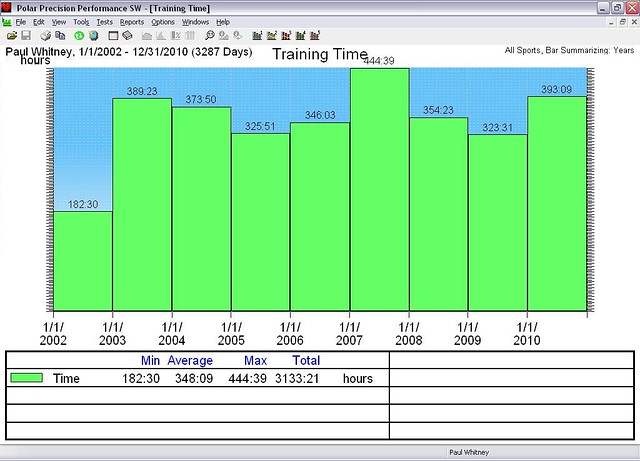
It's 2010, early October and the rando season is mostly winding down. But - there's one more ride on the schedule. I sign up for it. Nat signs up for it. Norm signs up for it.
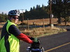
Bikenfest. We eventually figure out that we're carpooling from Richland to the outskirts of Bingen to start a ride at 7:30am. To do this we meet at the house at 4:00am to load the bikes and start. To do that I'm promptly in bed asleep by 1:00am the night before. With the usual preparations out of the way, we set off in the dark, driving. Stop at McDonalds for breakfast-analog (Biggs). The tollgate for the bridge over the Columbia at Hood river. Metal grids. Different patterns of metal in different places. Left turn into the park and ride. Bicyclists. We're there as well. 7-ish. We prep the bikes. Register. Greet the other cyclists. It's shaping up to be a great day.
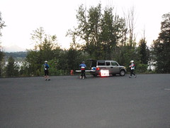
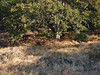
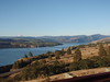
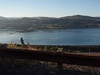
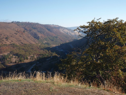
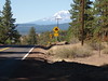
We're off. I turn back to check that the van is locked. It is. I've lost 5 minutes but think I might be able to catch back on. I sort of do. Nat's pedal has de-constructed itself. He's walking up and down the shoulder of Hwy 14 along the Columbia, and trying to find pedal parts. Norm and I press on. The route takes us up and away from the 14. Some good views of the river. Many others have photographed the view as well; but, here are my contributions.
We gain and then lose on the order of 600feet of elevation. A nice road that ends back along 14.
We cross the Klickitat river, enter Lyle and then a left turn that goes UP. So Norm and I are cycling up. Glasses fogging. A cloud in the valley. It's steep. The altimeter shows rapid elevation gain to go with the slow accumulation of miles. I've been here before (a slow start on a timed ride) and know I'll be able to meet the time gates. We climb. Stop for pictures or clothing adjustments.
Somewhere in there I disappear one of the PB&Honey sandwiches (on marble rye) that I've prepped for this. I'm having trouble keeping up with Norm. He's a much stronger cyclist than he was back in March. No comparison. We start to see another rider. Ken. I didn't know that for awhile since we had trouble getting up to him, and only connected at the top of the ridge. He coasts away from us on the other side and I'm still trying to figure out how he did that. The other effect of the crest is the change in vegetation. We went from trees to grass, abruptly.
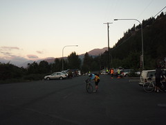
And we're up on a plateau. Open. We can see Centerville in the distance. The zig-zag road pretty much has that as the only option. We're there. The Kramer is there. Water. Conversation. He's disbursing snacks. I go with the Lara bar (I'm a sucker for those) and, on a whim, salted cashews (from Costco). The Kramer reminds us to carry lots of water from Goldendale to Glenwood. We're off. And eventually in Goldendale at the 76.Subway.DQ. Lotsa bicyclist cooling there jets there. I pick up water, a coke and some rollos (I still have those - must remember to eat them later. Can't go wrong with chocolate and caramel). We head out fairly quickly - didn't want to spend a lot of time at that control, especially when there's a prospect of a hamburger/fries/coffee at the next control.
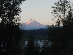
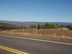
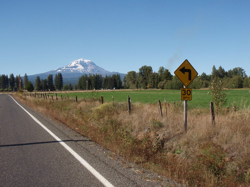
Norm and another rider drop me on this leg. There pace wasn't in me - but mine's plenty fast enough. Look left: it's Mt Hood. Look right: it's Mt Adams. We're surrounded by agriculture.
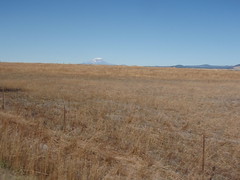
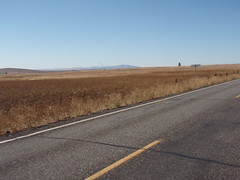
Fields. Cows. Hood. Adams. I'm pedaling. The coke is going going gone. I can sometimes see Norm and the other ahead. I figure they're finishing the ride before me, and continue at a pace. My pace. I've ridden this rode before, and the cue sheet is complete w/ elevation profile. The Klicketat river valley is shielded by slight ridge. I get to the top of the ridge and adjust. The cashew packet is opened and placed in a side pocket of the front feedbag. I get a picture.
Drink some water. And then the bike and I dive into the canyon. First overlook there's some folks taking in the view. I wave. They wave. I'm checking the mirror. Nobody behind me. Taking the corners carefully. Life's good. And in a short number of minute it's the bottom of the canyon. Hello river.
Now comes the part where we climb out of the valley. It's a short climb. 1000 feet of elevation (that's about an hour of riding). I do two things on this climb. I have the music on (hard rock works well for me for climbing. The playlist starts with Karma to Burn, winds its way through some related music. I rarely climb something so long that I get to the Hallelujah chorus - didn't this time). I'm eating the cashews. I've ditched the outer layer of clothing for better heat dissipation. And I climb. The bike shorts are black and I can feel the burn from the sun. That's weird. I check: plenty of water. Departed Goldendale with the two water bottles on the bike, and a bonus bottle in the front bag. Also weird is I'm starting to catch up to people that had dropped me earlier. I'm feeling good. There's Ken. I'm caught by Bill Alsup - he's taking pictures of us as we monkey our way up the road. I catch Norm. Start pulling him along. Some yo-yo-ing. Another rider or two ahead and they were very catchable except that Norm and I have other agenda. We agree that the burger/coffee/fries in Glenwood is the way to go. We're an hour ahead of cuttoff times, and so stop. We eat. It's good. The waitress is so kind as to refill our water bottles with ice water. We thank her profusely. And head out.
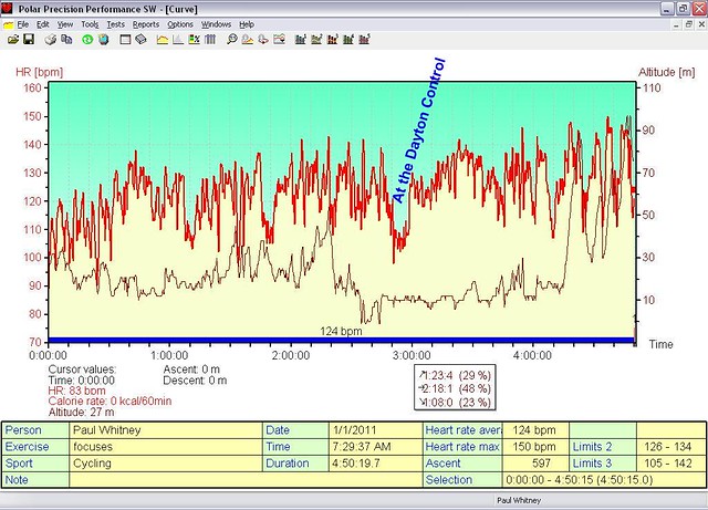
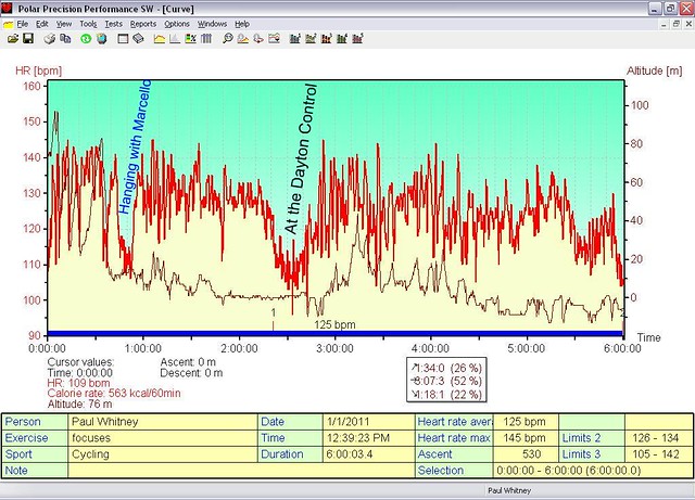
The ride is straightforward from there. A modest climb. Some steep bits. There's Ken again (he'd stopped at the store instead of the diner). Good clean fun on the descent. Trout Lake. Out to the stop sign. It's still light; but, want to make this the last stop before we get in for the evening. We dork up: Reflective gear. Lights on. And, for the first time, I'm cycling from Trout Lake to Bingen in daylight. It's easier than in the dark (anybody surprised?). I see the place where, a couple of years back, Nat and I hung out with Peg waiting for her wheel to arrive. We're falling quickly: lots of 25mph, and ranging from 15-30mph. Our mass is finally working for us. It's getting warmer as we get lower. Some condensation on the handlebar - I move the phone from the mesh on the outside to inside the bag. Light traffic. We make the traditional laments about the climb at the end of the descent before the final descent. In the daylight you can see that you don't want to veer off the road to the right. It'd be a tumble. And next thing you know we're done. I'd figured it for a 12 hour adventure but only ~11:30. Should have dawdled better.
John often has mementos to commemorate the events he organizes. Not to mention the cue sheets; well thought out design. This time, he had these pins for the riders:
It was great. Now I have to figure out what's in cashews.


