Monday, October 04, 2010

Bikenfest

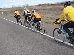
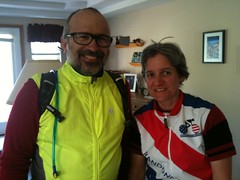
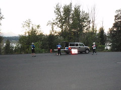
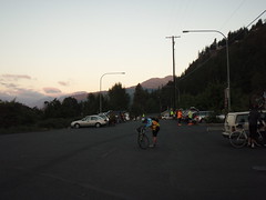
It's 2010, early October and the rando season is mostly winding down. But - there's one more ride on the schedule. I sign up for it. Nat signs up for it. Norm signs up for it. Bikenfest. We eventually figure out that we're carpooling from Richland to the outskirts of Bingen to start a ride at 7:30am. To do this we meet at the house at 4:00am to load the bikes and start. To do that I'm promptly in bed asleep by 1:00am the night before. With the usual preparations out of the way, we set off in the dark, driving. Stop at McDonalds for breakfast-analog (Biggs). The tollgate for the bridge over the Columbia at Hood river. Metal grids. Different patterns of metal in different places. Left turn into the park and ride. Bicyclists. We're there as well. 7-ish. We prep the bikes. Register. Greet the other cyclists. It's shaping up to be a great day.

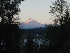
Ride Start Ride Start Mt Hood - From the ride sign-up area

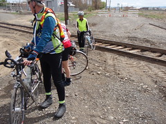
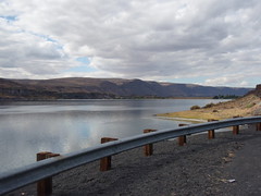
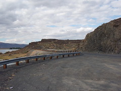
We're off. I turn back to check that the van is locked. It is. I've lost 5 minutes but think I might be able to catch back on. I sort of do. Nat's pedal has de-constructed itself. He's walking up and down the shoulder of Hwy 14 along the Columbia, and trying to find pedal parts. Norm and I press on. The route takes us up and away from the 14. Some good views of the river. Many others have photographed the view as well; but, here are my contributions.

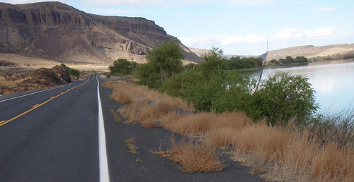
Along the road Along the road Mt Hood - seen from our first climb Columbia River - seen from our first climb Norm at first information control

We gain and then lose on the order of 600feet of elevation. A nice road that ends back along 14.

We cross the Klickitat river, enter Lyle and then a left turn that goes UP. So Norm and I are cycling up. Glasses fogging. A cloud in the valley. It's steep. The altimeter shows rapid elevation gain to go with the slow accumulation of miles. I've been here before (a slow start on a timed ride) and know I'll be able to meet the time gates. We climb. Stop for pictures or clothing adjustments.
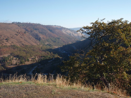
View along climb up to the plateau

Somewhere in there I disappear one of the PB&Honey sandwiches (on marble rye) that I've prepped for this. I'm having trouble keeping up with Norm. He's a much stronger cyclist than he was back in March. No comparison. We start to see another rider. Ken. I didn't know that for awhile since we had trouble getting up to him, and only connected at the top of the ridge. He coasts away from us on the other side and I'm still trying to figure out how he did that. The other effect of the crest is the change in vegetation. We went from trees to grass, abruptly.
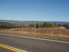
Looking back towards the tree-covered parts

And we're up on a plateau. Open. We can see Centerville in the distance. The zig-zag road pretty much has that as the only option. We're there. The Kramer is there. Water. Conversation. He's disbursing snacks. I go with the Lara bar (I'm a sucker for those) and, on a whim, salted cashews (from Costco). The Kramer reminds us to carry lots of water from Goldendale to Glenwood. We're off. And eventually in Goldendale at the 76.Subway.DQ. Lotsa bicyclist cooling there jets there. I pick up water, a coke and some rollos (I still have those - must remember to eat them later. Can't go wrong with chocolate and caramel). We head out fairly quickly - didn't want to spend a lot of time at that control, especially when there's a prospect of a hamburger/fries/coffee at the next control.

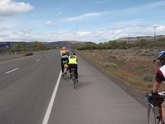
Norm and another rider drop me on this leg. There pace wasn't in me - but mine's plenty fast enough. Look left: it's Mt Hood. Look right: it's Mt Adams. We're surrounded by agriculture.
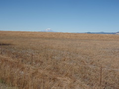
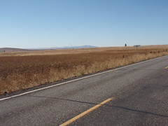
Agriculture - and Mt Adams in the distance Agriculture on the plateau, Hood in the distance

Fields. Cows. Hood. Adams. I'm pedaling. The coke is going going gone. I can sometimes see Norm and the other ahead. I figure they're finishing the ride before me, and continue at a pace. My pace. I've ridden this rode before, and the cue sheet is complete w/ elevation profile. The Klicketat river valley is shielded by slight ridge. I get to the top of the ridge and adjust. The cashew packet is opened and placed in a side pocket of the front feedbag. I get a picture.
The start of the Klickitat River Canyon - about to dive in
Drink some water. And then the bike and I dive into the canyon. First overlook there's some folks taking in the view. I wave. They wave. I'm checking the mirror. Nobody behind me. Taking the corners carefully. Life's good. And in a short number of minute it's the bottom of the canyon. Hello river.

Now comes the part where we climb out of the valley. It's a short climb. 1000 feet of elevation (that's about an hour of riding). I do two things on this climb. I have the music on (hard rock works well for me for climbing. The playlist starts with Karma to Burn, winds its way through some related music. I rarely climb something so long that I get to the Hallelujah chorus - didn't this time). I'm eating the cashews. I've ditched the outer layer of clothing for better heat dissipation. And I climb. The bike shorts are black and I can feel the burn from the sun. That's weird. I check: plenty of water. Departed Goldendale with the two water bottles on the bike, and a bonus bottle in the front bag. Also weird is I'm starting to catch up to people that had dropped me earlier. I'm feeling good. There's Ken. I'm caught by Bill Alsup - he's taking pictures of us as we monkey our way up the road. I catch Norm. Start pulling him along. Some yo-yo-ing. Another rider or two ahead and they were very catchable except that Norm and I have other agenda. We agree that the burger/coffee/fries in Glenwood is the way to go. We're an hour ahead of cuttoff times, and so stop. We eat. It's good. The waitress is so kind as to refill our water bottles with ice water. We thank her profusely. And head out.
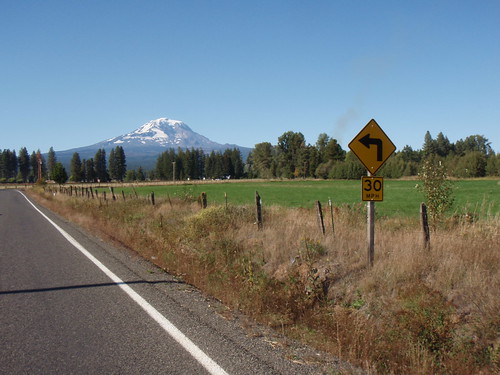
Adams - near Glenwood

The ride is straightforward from there. A modest climb. Some steep bits. There's Ken again (he'd stopped at the store instead of the diner). Good clean fun on the descent. Trout Lake. Out to the stop sign. It's still light; but, want to make this the last stop before we get in for the evening. We dork up: Reflective gear. Lights on. And, for the first time, I'm cycling from Trout Lake to Bingen in daylight. It's easier than in the dark (anybody surprised?). I see the place where, a couple of years back, Nat and I hung out with Peg waiting for her wheel to arrive. We're falling quickly: lots of 25mph, and ranging from 15-30mph. Our mass is finally working for us. It's getting warmer as we get lower. Some condensation on the handlebar - I move the phone from the mesh on the outside to inside the bag. Light traffic. We make the traditional laments about the climb at the end of the descent before the final descent. In the daylight you can see that you don't want to veer off the road to the right. It'd be a tumble. And next thing you know we're done. I'd figured it for a 12 hour adventure but only ~11:30. Should have dawdled better.

John often has mementos to commemorate the events he organizes. Not to mention the cue sheets; well thought out design. This time, he had these pins for the riders:
The Ride Pin

It was great. Now I have to figure out what's in cashews.
Monday, May 31, 2010

Brevet Prep and Flat-Yak 200km Ride

After some extensive recovering from the DRR 400km - and just letting the ORR 600km go - began prepping for the SIR 600km. This ride goes over 4 passes, and then adds a gratuitous loop around Lake Sammamish - to get the length to add up to 600km. I'd attempted this route 2 years ago and failed-and-bailed at 400km. Rematches are rare - I have a good success rate in rematch-rides.
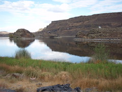
The recovery phase had to address knee issues and overall fitness. I made some progress on the knee:). Regular weights.
I also worked on the bike. Changed my position on the bike - setting the seat a bit further back. And put the mountain bike gearing on the brevet bike - in recognition of the climbing to be done. Also put on the 'west-side tires': currently Pasala's. I run more flat-proof (and heavy) tires regularly in the east.

Pie Plate

I needed an appropriate test of the bike/rider assemblage. An available ride is the Flat-Yak 200km. It's a relatively easy 200km ride - out and back from Richland to Toppenish/Zillah, with some variations to make the ride more interesting. So I'm off on a Sunday. The ride-thought is to keep the heart rate around 120bpm - this level of exertion will be fairly easy on the joints. And I'll get to see what that effort-level translates into distance and time.

It's always hard to get out of bed early on a potentially lazy Sunday to ride a bike for a semi-absurd duration. But, I do this regularly. The night before is key - prep a lot so it's a quick exit. Get the bike into the den. Make a PBH sandwich. Fill the water bottles (and place in the fridge - under the sandwich). Pack the handlebar bag. Remember the frame pump. Etc. I'm down the hill at the Starbucks a little after 7:00am for my 'official' start time of 7:00am. A donut and part of a cup of coffee later (~7:15-20) I'm on the bike heading West. I finish the coffee while riding and press on. Distracted. I miss a turn on this route I've created and get a couple of bonus miles on Keene. But, otherwise no issues and arrive at Prosser.

It's water, receipt and out. I'd gotten a late enough start that this was a little close, in time. But, I get there w/ about 15 minutes to spare. And depart quickly. Right after Prosser I get to ride here:

Byron Road

And then it's the long stretch to Toppenish. Sometimes on this part of the ride there are views of Mt Adams, and sometimes it's enough to keep oneself entertained while passing the distance.

Mt Adams in the Distance View on the Bike

I get to Toppenish. The Safeway. The half-way point. Coffee and water. I'd finished the sandwich already. I'm sitting there, drinking coffee and taking in the news of the day, and a young man joins me in rando-vagrant-mode. He (reflexively?) asks me for change. I can't say no. Before I can hand it to him he's greeted by a local woman (my age?). He comes back and I offer him the coinage. I get to hear about his life. Relatives. Behaviors. Thinks of being a DJ. He offers to sell me some artifacts. I look; but, I'm not a collector. A friend/acquaintance of his shows up. Wasted. That's my cue to get going.

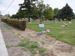
It's a short ride to the info control at Zillah. The information is on a sign at this cemetery. More flowers than I've ever seen here before. And people staring at the ground.

Zillah Cemetery w/ Flowers

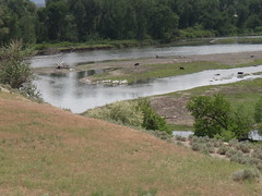
And on through Zillah. Granger. Then one of the nicest stretches of scenery, and quietest roads on the route. Emerald Rd. There's the Yakima river to the right. Orchards to the left. A few houses around. I get a couple of photos of a flock of pelicans. Also saw a Bald Eagle. Huge.

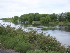
Pelicans on the Yakima

Eventually I return to the relative civilization of small towns. Sunnyside. Grandview then Prosser again. One more refueling - water, coffee, ice cream sandwich. Home by 6:40 (official ride end: 6:27).

Everything seemed to mostly work. Looking forward to a big ride this next weekend.

Sunday, May 09, 2010

Getting Ready for Next - Update

Ended up switching to the SIR 600km, June 5. Switch is motivated by work schedule giving the knee a little more time to recover, and additional training time. I attempted this ride a couple of years ago - had a great time but bailed at the 400km mark. Rematches are rare - so will make the most of it. Here's a sketch of the ride:


View Larger Map

Sunday, May 02, 2010

Getting Ready for Next

Next is the Oregon Randonneurs 600km Brevet. A week after finishing the 400km, the body is mostly recovered but with some issues remaining with the left knee. Other issues that emerged on the 400km were saddle related, and upper body/shoulder strength. Accordingly, I've been lifting weights, and listening to the knee. The essential physiological preparation is boring: clean living and exercise. So, it's weights/cardio/stretching every other day, along with (relatively) gradual re-entry on the bike. This next weekend is a local century: The Inland Empire Century. I'm planning to ride it with a couple of rando-riders. If that's ride-able, then will proceed with the 600. If not, probably not.

Bike prep is straightforward - changed out the saddle to a well-tested Brooks, and will add some lower gears to help with the steep climbs along the Oregon coast. The ride is unsupported - with an overnight about 360km in at Lincoln City. I intend to carry everything with, as opposed to using a drop bag.

Wednesday, April 28, 2010

DRR 400km - A Ride

Everything happens in 400km, and it takes a day. So it's my favorite distance of all the standard brevets. This one saw 10 of us at the start of the ride - the first ever 400km brevet hosted at the Tri-Cities. I'd hoped for five riders and was pleasantly surprised by this turnout.

The ride took us out to Ellensburg and back, with a slight deviation in Yakima just to get the distance up to 400. We started at 6am from Nat's. I spoke briefly with Ken Bonner at the beginning of the event, and as we wound our way out to the main road. Then he and a few others were gone. In short order, John Kramer decided he'd head up the road as well. We eventually split into ~3 groups. I was part of a good group of five riders. We tended to ride together, as it turned out it was a very windy day.

The weather forecast leading up to the ride had a humorous quality: Friday - a great day. Sunday - a great day. Saturday - lotsa wind. The forecast was correct - but it started out as 'ordinary' wind before graduating to '*$&@#!' wind. As part of the pre-ride briefing - I'd told folks that there were two good indicators to stop riding in the wind: 1) a lot of dust in the atmosphere (who wants that in their lungs) and 2) inability to hold a straight line on the bike (who wants to be blown off the road or into traffic). I'd suggested that it's OK to not worry over intermediate control times - thinking that it'd be in our face all the way out to Ellensburg. And that it'd blow us back to Richland. That was half right.

I was riding with Peg W and Norm Carr to Prosser - closely followed by Roger and Ali Holt. For Norm and I - the first leg was a standard ride at this point: the same as the 200km we did earlier in the year. The Prosser control was welcome, and we showed up with something over 30 minutes 'in the bank'. Neither bad nor good for 50km into the event. Some food and liquids and then we headed out. I like the first part of the next leg - it's a nice road along the Yakima River. Then we turn out onto Hwy 22 and it gets less interesting - except for the clean and near uninterrupted exposure to the wind. We caught up with Roger and Ali and spent a good amount of this distance riding in groups of 2 or 3 or 5 together.

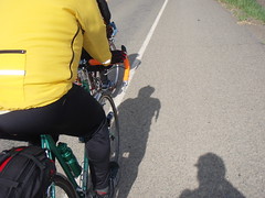
This photo shows three of is in echelon:

Shadow Echelon

This photo shows Peg pulling - for awhile we fell into a decent paceline - effective even at slow speeds due to the headwind.

Burning rubber

The wind bunched us up. Roger and I got into Toppenish first - then Norm. Peg and Ali accrued some bonus distance and then we were all at the Safeway - taking in a meal and the morning. Norm, sensibly, left us at this point. Another rider, Sam, had calculated and decided that the wind was going to cause the ride to take too much time. The rest of us would finish the ride. At the Toppenish Safeway: Coffee and a sandwich after a good chunk of a bike ride. Can't beat it.

Rando Chow Peg in the Toppenish Safeway Roger and Ali in Toppenish

So four of us head out from Toppenish towards Yakima. There is some wind-shielding on Track road that wasn't available on the Highway. And somewhat less traffic. It went well - but we ran out of road a little earlier than planned - arriving at some track-related road deconstruction. The gravel was rideable but this wasn't:

Rando/Cyclo-cross

So, we rejoined the main road and headed into Yakima. The wind was diverted, briefly, by the hillside. We made up a little time.

Heading towards Union Gap

The route took a cloverleaf to get us into the city of Union Gap. We negotiated that fine, and ended up riding through the town. And then took the left towards Wiley City. The road surface and traffic varied - but it was a nice enough route. A very steady and gradual uphill.

We get to Wiley City - fuel etc. And head out. Ali had mentioned a hill that we might have to climb. I was having nothing to do with that at this point - must have needed more fuel/food. She was correct. We climbed it. Short and steep. Then zigzagged up, down, generally down into Yakima. A pit stop at a local McDonalds and then we found the bike path from Yakima to Selah. Then the canyon. We separated into pairs in the canyon. Peg and I riding slightly ahead. Two main climbs in the canyon and Peg easily outclimbed me. I caught her on the first downhill - and then again on the second (since she'd stopped). It was heading towards sundown and the temperature was dropping. But a nice evening. We'd seen Ken Bonner shortly after we entered the canyon - then we saw the other three riders as we left the canyon heading into Ellensburg (somewhere around here John Kramer texted a concise ride report: "Uffdah"). Another town another Safeway. But its inner-starbucks had already closed for the evening. We got some food. And agreed w/ Ali and Roger (just a few minutes behind) that we could meet at a stand-alone Starbucks on the way out of town. Did so. I ate my safeway sandwich, drank half a latte. Then Peg urged us all outside before we "got too comfortable". We booked it out of town. Slightly gapped Roger and Ali and played control-tag with them all the way back to Richland. We approximately had the wind for this leg: Ellensburg to Yakima. It was a nice ride back through the canyon. Crossing back over into Yakima - we entered town at night (must have been pusing 11pm). No traffic issues. A nice ride on 1st street, then a left on Nob Hill and we found the 76. The person behind the desk knew the card-signing routine and we happy to sign ours - the folks preceding us (Ken, John, Mike and Karel) must have made a great impression with her, and all of the other folks at the service stations and stores. They were always smiling when they saw us. All of this despite Peg and I starting to go into full-on Rando-vagrant mode.

Eating at the 76 on Nob Hill in Yakima Paul's Yakima Chow

The 76 chow was cup-of-soups, ingested in the store while sitting on cases of motor oil. Zillah - there was one table in the Chevron. Prosser - we used the Shell truck-stop. Plenty of tables and local color. Benton City - who can ever forget the outside pond with the adjoining BBQ?

Anyway - there we are at the Yakima Nob Hill 76. Me, Peg and the proprietress. She's deeply amused and trusting us (no reason not to, as it turns out). Steps outside for smoke while Peg and I are swilling down a cup-o-noodles each. It's good but time is pressing. We head it towards Moxie. I've never been. And I guess I still haven't. The road skirts the town and then pushes us south towards Zillah. It's all getting bleary but we're biking on. We spend a lot of time on 'Konnowac Pass Rd'. I'm starting to put it together - the name, the curve of the road on the map. Means one thing: we have a climb somewhere in this. It's true. We climbed. But - the best part is that some of the local artists had adjusted the reflectivity of the road signs. So that some of the letters in the words 'Konnowac Pass Rd' are not visible. Taking out the 'P' was obvious - but the adjustments on 'Konnowac' took some thought. Anyway - we're climbing up. The road surface has some fractal dimension close to 2. Then we get to descend to the Yakima Valley Hwy. I'm feeling pretty good at this point, since this puts us a little over 100km away from the finish (doable) on roads I've bicycled before (very doable). Too bad the wind had died down - and was slightly in our face. We get to Zillah.

Roger and Ali pull in shortly after us. They're making the time limits, as are we - with never more than an hour to spare. Sometimes with just minutes. But we're slogging it through. Peg and I head out from the Chevron through the sleeping town of Zillah. She's not impressed by the teapot. It takes us forever to get to Sunnyside. We try the bike path briefly on the other side of Sunnyside - to stay out of traffic. At this point I'm having some issues staying awake while riding. Nothing unmanageable so much as annoying - sleepiness messing with my enjoyment of the moments. We look for caffeine tablets in Grandview. We strike out. But we get to Prosser. The truck stop. Food, tea (easier on the stomach than coffee) and vivarin. I haven't used this particular form of substance since undergraduate school. I still remember trying to write a paper, due the next day. That caffeine pill kept me up, but so wired and shaky that I couldn't start writing till 5am or so. But, I'm game to try one of these again - three+ decades later. Peg is kind enough to spot me a vivarin. I read the label. I accidently start reading the inert-ingredients. This is kind of a long list. I remember reading the titanium compound on the list - then realizing that 1) I am reading the inert ingredient list 2) titanium is very appropriate for a rando event (although I'm using the steel) and 3) the orange color it induced is hilarious as it is not a very food-like color. I eat it and hope for the best.

For actual food: I'd chosen the item with the most calories that I thought I could eat (and then retain while riding). We'd shown up at Prosser at a reasonable hour - some of the local folks were awake and having their morning coffee. They greeted Peg and I with a comment (I'm paraphrasing): "I see you're with your daughter: your youngest daughter". I thought this was a good shot/comment, but wasn't in good enough shape to visibly appreciate it. So they repeated it a few times:). Nice guys. One of them was the ex police-chief of Prosser. Peg chatted with them briefly. Peg and I took a 'head-down' brief nap. Somewhere along the way I started having issues with the functioning of my left knee. It hurt when I bent it. Not so good when one is trying to pedal. It hurt a lot when I pedaled standing-up - so I didn't do a lot of that. Ibuprofen helped somewhat. It hurt less as the day started warming up. Anyway, the food, vivarin, tea etc all helped. We headed out of Prosser, on fire, relatively speaking. I see on the speedometer, somewhat consistently, 13-14 mph.

An hour later - it's daylight (has been since Prosser) and we're a couple of short climbs from Benton City. But I'm starting to fade - limited power on the bike - can't get the heart-rate over 110 (a solid sign I'm out of fuel). I make some comment, Peg agrees: "yep, you're running on fumes again". We stop in Benton City. Can you believe they don't have donuts on Sunday's at the gas station? Donut-free - just on Sundays. I choke down a hostess cupcake (dryer than a fresh donut), another vivarin, half a cup of coffee (just to make sure I've had enough caffeine) and we're off. Peg had stayed outside so she wouldn't get "too comfortable". I'm starting to sense a pattern.

We're pretty much done. Just pedal. These are extremely familiar roads - I probably ride them in my sleep. We crest the hill outside of Benton City, coast down to Bombing range, some road-ridng, a bike path, up to the elementary school and just about coast down to Nat's.

Nat's there. Sally. Two cats. He signs cards. He's been up all night reading my gripping facebook posts (ok, probably not). Nat takes our picture. I've called Julie asking for a lift home. Sure - we can ride 250 miles. But not 252.

We'd timed our departure from Prosser so that we'd finish the ride w/ 30 minutes to spare - enough time in the bank to handle one mechanical incident. We finish w/ 30 minutes to spare. Roger and Ali show up right after us. Ali enjoys the cats. We all chat briefly. I hope to see them on a ride in Canada in 2012, and before. This was a great weekend.

400km Stare

Sunday, January 31, 2010

Bike Maintenance

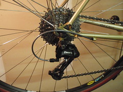
One of the simple pleasures of riding is working on the bike. I had a couple of items to work on: the bottom-bracket/crankset area was clunking a little, and I had an new derailleur to install. Went ahead and replaced the chain while I was in the neighborhood. Started with the derailleur. The key difference between this one and the previous is the bearings on the pulleys - I'm hoping for better weather resistance. Got it installed and adjusted easily enough. Used a new cable.
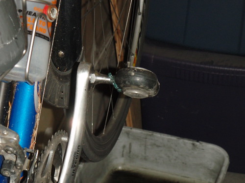
The tricky bit was the clunking in the crankset area. Taking the bottom bracket out showed some thread-loss on the drive-train side - on the outer part of the bottom bracket. I'm not sure how the threads were lost - but, I'm now in the market for a replacement.

Sunday, January 18, 2009

Information

Clodfelter above the Tri-Cities

From the RUSA web-site:

"Where it is difficult to eliminate a potential shortcut from a route, an information control may be specified. In this case, the rider answers a question, posted on the brevet card, about the control location, e.g. name of a business or church, color of a house etc."

I needed an information control to complete a permanant route; but, the weather hadn't been cooperating. We've had, for the most part, too much snow and ice to drive to the route, much less ride it. Today was the day, however. Not a work day, and good enough weather. There was the freezing fog up high. It looked great. Down low, the h2o was liquid. RUSA member #5081 and I drove it - documenting a few very findable yet unique points of note in the canyon between Echo and Pendleton. We stopped for lunch in Pendleton - The Hut was closed (apparently closed on Sundays) but the restaurant across the street, The Mazatlan Mexican Restaurant had a fine Veggie burrito and a nice enough cup of coffee. Then home.

Wednesday, November 26, 2008

Year End Wrap-up

Yep - it's not the end of the year; but, I'm calling it anyway. It's done. This bike-season is now complete. If necessary, one can think of it as like x-mas music and decorations at malls - earlier and earlier. As commercial-x-mas-season-start creeps forward so does the end-of-bike-season. It's called. This season of not-biking-enough is over. I reset the metaphorical odometer. It's finished. Moving on...Wait, a few rituals to ensure the finality of this season.

Tradition demands the usual end-of-season questions:

  • How many miles did you ride (5200km for me this year - should have been double that for optimal results)?

  • What are your goals for next year (ride more and enjoy it well)?

  • Any rando specific goals (yes - a super randonneur series, good progress towards an R-12 and a great kick-off of the Tri-Cities Area Randonneurs (TAR? - funniest option for a name yet. We could also get HAR - but, that's too obvious))?

  • Any new bikes on the horizon (yes - but not this year - whatever bike it is will come from the Northwest)?

  • High point of the previous year-in-cycling (Lots of candidates)?

It's enough. I think I'll ride tomorrow.

Extruded grease and pine needles

Monday, November 24, 2008

Around the Bend - A Monday's Ride


Well, it's sort of vacation time. And it's not raining or snowing. So, the road-bike is in play. Nat and I set out from the local Starbucks around 6:30am, and head out around the bend of the Columbia river. Mostly because we haven't ever been there and it's an appropriate distance for our current lack of conditioning. It's dark, below freezing, and the fog from the river dominates for awhile.

Fog frozen on roadside plants

The usual happens - ice in the beard. Cold toes. Nat's hydration pack hose collects ice. Mine doesn't - electrolytes. I'm toying with bailing; but, around Wallula I'm 'committed'.

As we get beyond Wallula the fog starts to break, and we're biking through the gap. It's spectacular. It's a truck route; but, the traffic is tolerable. The shoulder on the road (US 730) when entering Oregon get's too narrow for comfort. Light traffic though. Some folks are fishing in the Columbia as we ride by. The route is amazingly flat. We take it in and then we're in Umatilla. My favorite stop is the Tesoro. I have the coffee and chips; Nat goes with the subway. Here's a pic:

Still Life - Rando Style

Finally, we're left with the climb over Clodfelter. We do it. It takes a good amount of time - we're working, but not so hard that we can't talk. Then we get the descent. Still cold; but, easy work. Next month is a 200km.

Sunday, November 09, 2008

Brevets in the Tri-Cities, WA

Randonneuring is an organized form of long distance bicycle riding. And it's a blast. There is the benefit of meeting our fellow bicyclists, the interesting routes that take us to parts of our regions we wouldn't otherwise see, and the challenges. The distances are challenging, and the challenges ratchet nicely with ones abilities. Slower riders (like me) have the challenge of finishing within the time limit, faster riders can try to best their previous marks, or take advantage of the time for photo explorations, diner diving, etc.

Good description of Randonneuring and the rides (Brevets) are available on the web-sites linked below (don't miss the RUSA web-site), and here: http://www.randonneurs.bc.ca/introduction/intr_txt.html.

The national organization for Randonneuring in the US, RUSA - http://www.rusa.org, breaks the country into (approximate) regions, and in my part of the world the closest regions are in Portland, OR - http://www.orrandonneurs.org and Seattle, WA - http://seattleinternationalrandonneurs.org. Each of these is a good 3-4 hour card drive from the Tri-Cities, so, we're going to run a couple of Brevets (the rides) from the Tri-Cities this next year (under the auspices of the Oregon group).

The two rides we currently have schedule are a 200km Brevet on April 18, 2009 and a 300km Brevet on May 2, 2009. If we have enough participants, we'll expand our ride offerings in the next year and perhaps form a region. Stay tuned!

Richland-Pendleton-Richland - RUSA Permanant 567


This (proposed)permanent route starts in Richland, WA - and takes the 'natural' route to Umatilla, OR, and then to Pendleton. And then you reverse course and head back. The distance is a safe-and-sane 210km. The highlights of the route include a nice climb up Clodfelter, a bike path over the Columbia River, a ride along the Umatilla River from Umatilla to Hermiston, and, the canyon road from Echo to Pendleton. Some photos, for preview purposes, are here and here.

More details:
The precise start location is the intersection of Leslie and Gage roads in Richland, WA. There are numerous potential card-signing/receipt-offering mechanisms near this intersection. Albertsons (also has an ATM inside (and a Starbucks)), Albertsons Express minimart, a Shell minimart and a stand-alone Starbucks.

There are five controls: Richland, Umatilla, Pendleton, Umatilla and Richland. The control on Pendleton is open. There are a variety of options in Pendleton - ranging from minimarts to restaurants. A recommended option in Pendleton is the Hut, see a previous posting for a description and coordinates.

A bikely-based description of the route is here.

The route sheet is here.

The overall elevation gain is approximately 2000meters - the biggest climb is the ridge between Richland and the Columbia river (a Clodfelter climb on the way out and a Plymouth Road climb on the way back).

Sunday, September 07, 2008

Biking North

Canyon

We set out to Grand Coulee Dam at 5:30am from the Starbucks in South Richland. The picture above is from North of Soap Lake - the best part of the ride. We ended up getting 190 of the 250 'available' kilometers, before being intercepted by our pick-up-person a few miles before Coulee City. The ride picked up nicely in scenery and traffic conditions (less!) From Moses Lake on, especially after the highway headed North towards Soap Lake.

The early start made for some interesting light-effects. The angle of the sun gets extreme and the smallest things cast shadows for the longest time. This picture captures it, somewhat. Between Pasco and Basin City. The yellow dot in the picture up ahead is one of us.

Sun's Coming Up

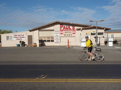
The bike ride North to Basin city has been great both times I've taken it - this ride is the second. There is light traffic, and a sense of direction and purpose (heading North, to get to Basin City. It works somehow). Basin City is small town, and seems to serve the local Ag community/industry. There are a couple of places to eat. I haven't stopped there yet but a restaurant-ride is a good option for the future. The place shown below - mini-mart/gas-station is abandoned.

P9060139

After Basin City, we get to climb. The name of the town makes sense. We climb up out of the basin onto a Plataea. While biking up, I'm interested in the road-cuts on the way up (I swear it wasn't to catch my breath - there are interesting features to be seen in the cross-sections). There's a lot of loose stuff that was cut-through to get up to the top:

Loose terrain P9060141

The ride North continues up on the top - some rolling, and then a ripping trip down into Othello. We take the traditional mini-mart stop before heading on North to Moses Lake. Pretty much the most direct way, by car or bike, from Othello to Moses Lake is Hwy 17. We take that highway. It's not a road I'd put cyclists on at all during the night. The rumble strip has eaten what little shoulder there is. I spend most of this part of the ride reflecting on that and swearing to find another way to bike between these two nice cities (still haven't found it).

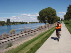
We stop in Moses Lake for a sit-down meal at a sports bar. It's great. We take a lot of time here. Finally we head out. I'd asked the proprietor for how to head north from there to get to the next cities (Soap Lake, Coulee City,...) and apparently muff the translation of his directions. We get to see a lot of Moses Lake before I head into a local Real Estate agent office for relief from our route miscue. The receptionist listens, gets out a Moses Lake map, points us to the bike path along the lake, and on North out of town. She also gives us the map. Very kind.

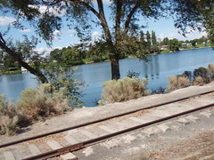
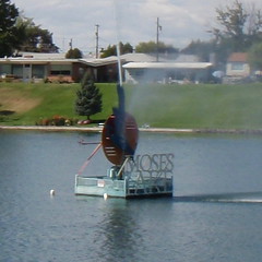
So, we bike out of town along the lake for which the town is named:

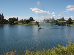
Along Moses Lake Moses Lake - The Lake Fountain Fountain

And then we're out of town. The road's great North of Moses Lake - much better than from Othello to ML. Traffic's died out a lot, and the topography starts to have a different feel. Here's the all-important views of the shoulder-riding-conditions:

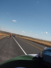
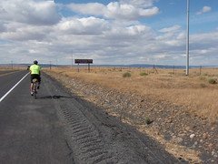
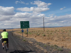
North of Moses Lake - Looking South North of Moses Lake - Looking North

The sign in the north-facing picture is kind-of amusing. It says Grand Coulee Dam next right. Not really a lie, but, the dam-and-destination is still 60-some miles away. We make the right turn. And it really starts to get good. This view is a hint:

P9060155

And I liked Soap Lake - we stopped at a drive-in on the way back. The malt was good. Just out of Soap Lake, the city, we're biking along Soap Lake - The Lake. I took my time:

Lake The scenery is cranking up a couple of notches
Where we were riding along the lake

And:

P9060171 P9060172

The traffic after Soap Lake was very light. I took a picture of the shoulder of the road, on-purpose, as a reminder and indicator. Weeds are growing on the shoulder:

Road side garden

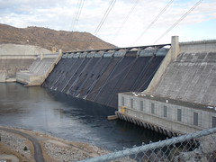
I don't know what else to say. We may have stumbled on the perfect time of year for this particular ride. We didn't quite finish it, though. Our arrangement was to ride North, and when The Driver intersected us, get in and call it good. She found us around kilometer 190. We were close enough to the Dam, and none of us had ever been there yet, that we drove north to take a look before heading back home. Another great day on the bike.

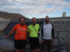
Grand Coulee Dam By Grand Coulee Dam